
Prism Map Studio · a Prism Labs product
A map workspace in your browser.
Add your own data, run more than a thousand analysis tools, ask your layers with SQL and make finished maps. Nothing to install, and your files stay in your browser.
Free for anyone, with no account, and it works on a phone too.
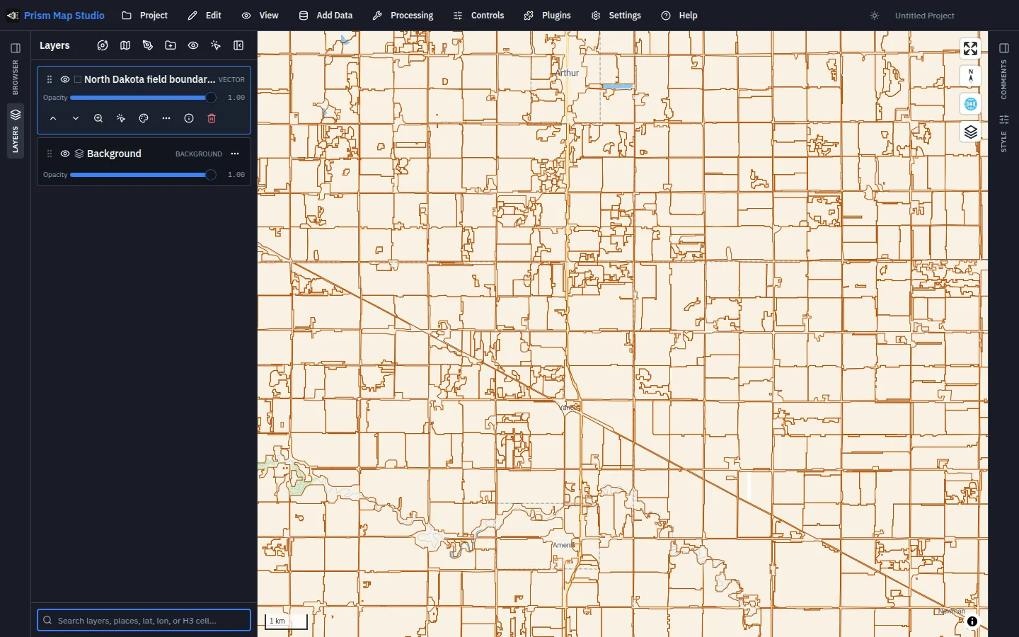
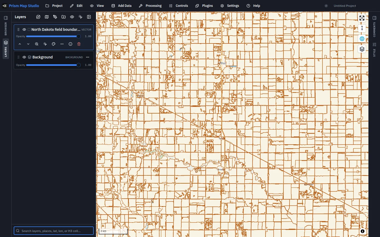
The live product, with North Dakota field boundaries from Prism Microclimate
Your data
Drop a file on the map. It stays with you.
- The formats you already have.Drag and drop GeoJSON, KML, shapefiles, CSV, GeoParquet and rasters straight onto the map, or add a map service or a cloud file by its address.
- Opened, not uploaded.Files you add are read inside the page. They are not sent to Prism or to anyone else.
- The work runs on your computer.Analysis, queries and styling happen in your browser tab, on your own machine.
- Nothing to install, no account.Open the page and start. The same workspace works on a laptop, a tablet or a phone.
Analyse
More than a thousand tools, in the browser.
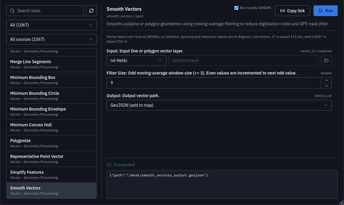
- Terrain and water.Slope, hillshade, watersheds, flow paths and wetness from an elevation model.
- Vector and raster.Buffer, clip, merge, smooth, simplify, reclassify and combine layers.
- Imagery and lidar.Remote sensing indices and point cloud tools for survey and drone data.
- Cloud formats.Convert your files to formats that stream quickly over the web.
Ask
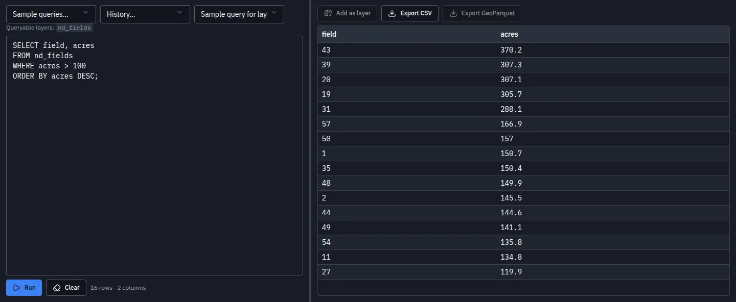
Ask your layers with SQL.
- Every layer is a table.Write a query over the layers on your map and see the rows at once.
- Results back on the map.Add the answer as a new layer, or export it as CSV or GeoParquet.
- Filters without code.Quick filters, joins and calculated fields for the questions that do not need a query.
Make the map
Style it, label it, print it.
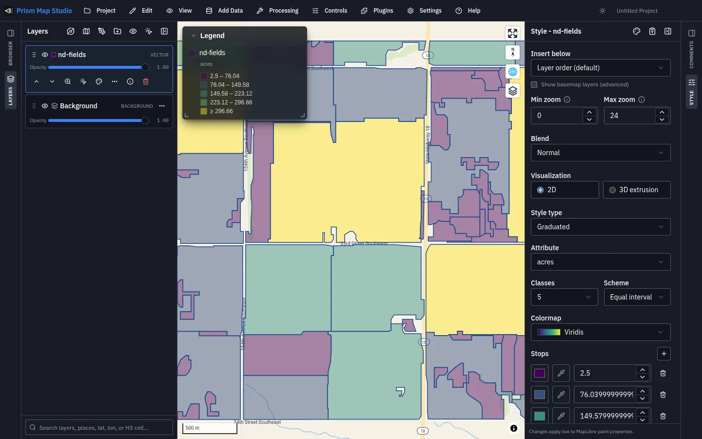
- Colour by what matters.Single colours, graduated and categorised styles, rules, patterns and 3D extrusion.
- Labels and legends.Label features from their own fields and add a legend that follows your styles.
- Print and export.Lay out a page for printing, or export the whole map as a web page.
- Story maps.Walk a reader through a place, one view and one paragraph at a time.
In the field
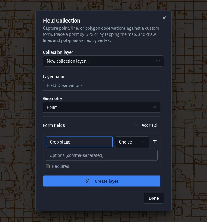
Collect data where it happens.
- Your own forms.Text, numbers, dates and choices, with the fields you mark as required.
- Photos and GPS.Place a point from your phone's location or by tapping the map, and attach a photo.
- Points, lines and areas.Draw what you found vertex by vertex, then analyse it back at the desk.
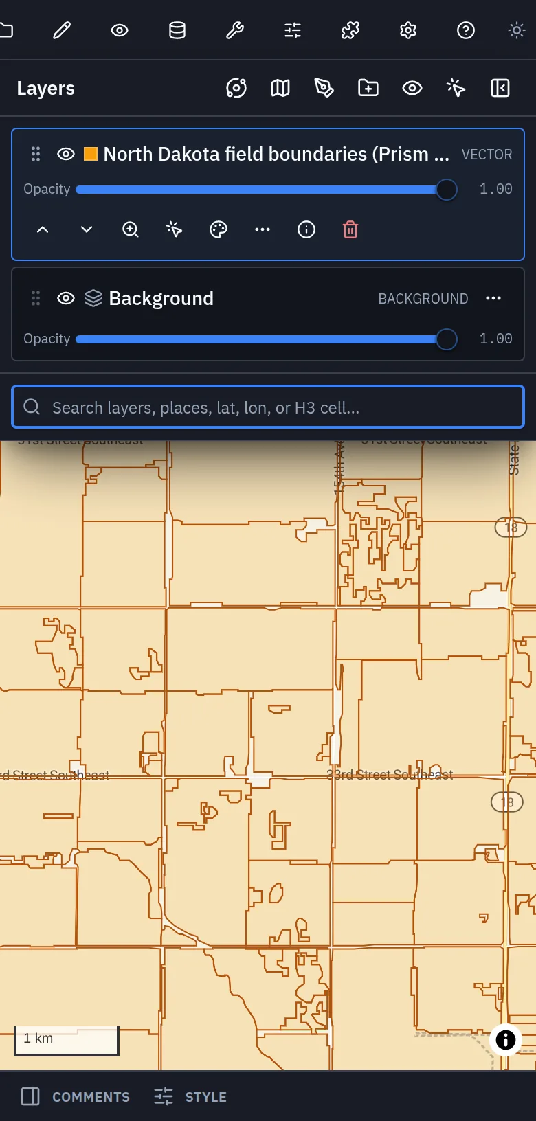
On a phone
The same workspace in your pocket.
Map Studio fits a phone screen. Open it at the edge of a field, check a layer, record what you see.
Works with Prism Microclimate
Every North Dakota field, ready as a layer.
Prism Microclimate's 961,439 field boundaries across North Dakota are a ready layer in Map Studio. Add them from My Data in the Browser panel, then measure, filter and style them next to your own data.
Part of one platform
One of the ways to work in Prism.
Every field in North Dakota, with its evidence.
Field-level weather, soil and risk for growers and the people who advise them.
See Prism Microclimate → Prism XHardware that joins the workspace.
Robots, sensors and edge computers that take a seat beside your people and your agents.
Meet Prism X → Prism DesktopOne workspace. Any AI. Your data.
Your team and your AI agents in the same channels, for chat, code, mail and meetings.
Explore the product →Where it stands
Where it stands, and what comes next.
Live and open to anyone since 27 September 2026, on a computer or a phone: more than a thousand analysis tools, SQL over your layers, finished maps, and every North Dakota field boundary as a ready layer.
- Pilots with analysts working on their own layers.
- Map Studio beside the rest of Prism, one of the ways to work in the same workspace.
The product is public, so validation is use: what pilot analysts map, and what they still take elsewhere.